Why Is There Still No Clear Answer to the Question: "How Can the Caspian Sea Be Saved?"
Many current proposals for saving the shrinking Caspian Sea bear a striking resemblance to relatively honest schemes of extracting money from the region’s governments and people.

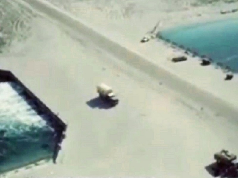
Photo: The dried-up Caspian Sea / by Azamat Sarsenbayev
That the Caspian is shrinking is a fact. In some areas, the shoreline has retreated by as much as 50 kilometers in recent years. Revived environmental organizations were quick to cite causes such as uncontrolled oil extraction, overfishing, and pollution from coastal settlements. But is that the full picture? No one can say with certainty when the sea might start… expanding again. Details from Cronos.Asia.
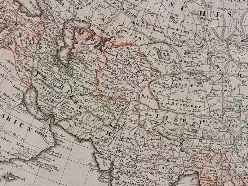
Recently, environmentalists, scientists, and public figures in Kazakhstan united to combat the escalating ecological crisis of the Caspian by launching the global movement Save the Caspian Sea. Yet, the human factor may be a secondary issue for the world's largest inland body of water. Over the past 400 years—a blink of an eye in planetary terms—the Caspian shoreline has changed multiple times. It has suddenly receded, only to expand just as dramatically. Was that due to human activity? Possibly. But how significant was human influence in the 17th or even 19th century? Likely minimal. However, the Caspian of yesterday and today are vastly different. Doubters can visit the second floor of Kazakhstan’s National Museum in Astana to see detailed 17th–19th century maps created by European cartographers—maps that bear little resemblance to the Caspian we know today.
What the Maps Reveal
Dutch and Italian maps from the 16th and 17th centuries show the Amu Darya and other rivers flowing into the eastern Caspian—rivers that are now mere memories. The Karabogaz-Gol lagoon is absent. East of the Caspian, there is no sign of the Aral Sea, though the Syr Darya appears flowing through a lake named “Kithay Lakus” or “Kithar Lakus.”
Only in 18th-century German maps do we see the Aral Sea appear, along with updated Caspian coastlines. The Karabogaz-Gol is still missing. By then, the Amu Darya had shifted to flow into the Aral, which itself stretched north-south, resembling the Caspian. The Caspian’s surface area was also much larger. For example, a 1793 map by Franz Ludwig Güssfeld shows the now mostly dry bays of Kayduk and Oily-Kul’tuk as once full of water. The former’s shoreline extended south of today’s Bozbak village (Mangystau Region), and the latter far east of present-day Beineu.
There’s even a theory that the Guryev Fortress—now Atyrau—was once directly on the seashore, where the Ural River flowed into the Caspian. In fact, it’s possible that much of modern-day Atyrau was underwater until the mid-16th century, with the shoreline stretching up to the medieval city of Saraychik—almost 50 kilometers north of Kazakhstan’s oil capital. Though speculative, these ideas are not unfounded.

From Uzboy to Bekdash
What is known for sure is that over the past century, the Caspian has experienced both regression and transgression. Its level began to decline unexpectedly after 1930, though the USSR leadership had more pressing concerns—industrialization, collectivization, electrification. The problem was only taken seriously in the late 1940s when the Caspian had dropped two meters.
Few recall Stalin's “Great Constructions of Communism,” such as the “Main Turkmen Canal,” which had two goals: irrigate new agricultural land and revive the dried-up Uzboy River (a former offshoot of the Amu Darya) that once flowed into the Caspian near Krasnovodsk (now Turkmenbashi), thereby halting the sea’s decline.
Legend even has it that fleeing Genghis Khan’s troops, Khwarazmshah Muhammad II traveled from Gurganj to the island of Abeskun (now Ashur-Ada, Iran) at the mouth of the Gorgan River—via the Amu Darya and Uzboy.
After Stalin’s death, the project was halted in favor of the Karakum Canal, which also aimed to bring Amu Darya water to the Caspian. For context: the Karakum Canal was completed in 1988 but never reached the sea. Why? Because after 1977, when the Caspian hit -29 meters below sea level, it began… slowly rising.
Soviet geography textbooks from 1977 still stated:
“A decrease in river flow in recent decades has lowered the Caspian Sea by almost 3 meters: bays have dried, islands turned into peninsulas, fish spawning conditions worsened, and port access has become difficult.”
Because of the rising sea level, several major Soviet-era projects had to be scrapped. In 1992, Turkmenistan’s President Saparmurat Niyazov ordered the demolition of a dam built in 1980 connecting the Caspian to the Karabogaz-Gol bay.

The bay had dried up within four years, halting production of mirabilite (sodium sulfate), vital to the chemical industry, and almost turning the town of Bekdash into a ghost town. There were also fears about port infrastructure in Krasnovodsk being flooded. Diplomatically, the dam was declared “no longer necessary.” Ironically, Soviet propaganda had previously blamed the bay for the Caspian’s regression—claiming that water entering the shallow bay evaporated rapidly “like on a giant frying pan.”
Kalamkas, Karazhanbas, and the Others
As the sea rose, the idea of diverting northern rivers to the Caspian was abandoned. By the late 1990s, both Turkmenistan and Kazakhstan were panicking. In a 1999 TV program about EU cooperation, former Kazakh Deputy Minister of Ecology Madi Kireyev warned:
“There’s cause for concern. The sea level is rising rapidly. Some decommissioned oil wells are now underwater. If they leak, the environmental impact could be catastrophic. Even active fields — Kalamkas, Karazhanbas, Korolevskoye, and possibly Tengiz—are at risk. We must build protective dams and barriers.”
He also noted infrastructure problems in the ports of Aktau and Bautino, both designed when the Caspian was shrinking.
“Aktau, for example, was launched in 1963, when sea levels were much lower. Now we must urgently upgrade piers and docks to meet the new conditions.”
Who could have predicted that after 2006, the Caspian would begin to regress again? Today, nearly 42 billion tenge (~$84 million) is allocated to deepen Aktau’s harbor. Environmental organizations warn of an apocalyptic future — by 2100, the sea could drop by 9 or even 18 meters. They blame oil companies, fisheries, polluting settlements, and Russia’s water usage from the Volga and Ural Rivers—plus climate change. The common message: saving the Caspian will require a lot of money.
An Unpopular Perspective
Yet as early as 2010, Turkmenistan’s geological research institute Turkmengeology published a paper predicting Caspian fluctuations. Led by academician Odek Odekov, they argued that the regression might be temporary, followed by another transgression. They foresaw a century or more of rising sea levels—punctuated by brief stabilizations or declines — driven by geological, hydrospheric, atmospheric, and even cosmic factors.
They pointed to tectonic activity in the Asia-Pacific and Alpine-Himalayan zones as key contributors to sea-level changes—particularly seismic events.
“These contrasting tectonic movements mainly cause the Caspian’s transgressions and regressions. Sometimes the seabed rises, causing the sea to spread onto land; other times, it subsides, and the sea retreats,” the scientists explained.
Indeed, a look at seismic history supports this. In March 1977, an 8.9-magnitude quake in Romania shook even Moscow. In January 2024, strong tremors were felt in seismically active Almaty. The Caspian began its transgression after 1977.
Major quakes (8.3 and 8.0) hit the Kuril Islands in late 2006 and early 2007—coinciding with the start of the Caspian’s regression. The 2011 Great East Japan Earthquake (M9.1) shifted the Pacific Plate by 20 meters. No further M8+ quakes have occurred since, but if another hits near the Caspian, another transgression might follow, validating the Turkmen scientists’ theory.
Final Thought
Despite decades of studying the Caspian’s fluctuations, no large-scale global research has ever accounted for all contributing factors. There’s no funding for that. Yet money is always found for “saviors” of the sea—who do little more than widen their eyes and call for bans, restrictions, and more oversight, while lining their own pockets with sturgeon caviar on toast. If anyone disagrees, Cronos.Asia is ready to host an open debate.
Russian version of the article:
Почему нет ответа на вопрос: "Как спасти Каспийское море?"
Любое использование материалов допускается только при наличии гиперссылки на cronos.asia.
Подписывайтесь на Telegram-канал Central Asia Cronos и первыми получайте актуальную информацию!


